 |
| One thing that's curious about the topography of Kakadu is that you can drive for a seemingly endless way through flat, (mostly) forested top end bush, then suddenly come upon an immense river that stretches off into the distance in both directions. In fact you can recognise a river simply because of the dense foliage growing along the edges of the waterway. This is the East Alligator River just a bit south of Cahills Crossing - the official border point between Kakadu National Park and West Arnhem Land. |
 |
| We saw a lot of 'salties' (estuarine crocodiles) on this stretch of river - there was one about every 20 metres or so - anywhere there was a beach for them to rest. The fella running the cruise told us it was because of the plentiful supply of fish in the river - they hunt and eat all night and lie bloated on the riverbanks by day. Despite warning signs at every river crossing in the park - and beyond - people continue to risk their lives by wading across the causeway, fishing too close to the water's edge or by getting out of a bogged vehicle looking for help. |
 |
| Another close up view of an East Alligator River saltwater crocodile (The river was first named by the explorer Phillip Parker King in 1820, because he'd learned about alligators and assumed that these were the same species). |
 |
| A good view of the Great-billed Heron along the East Alligator River. Listed as 'uncommon' in my hand book, this bird was quite a sight - over a metre high - though a bit shy we got a good view as we drifted past in the tinny. |
 |
| A Great Egret wandering along the sand banks of the East Alligator River. 1/1250s @ f8, ISO1600, ExComp: -1.3 stops |
 |
| South of Cahills Crossing we came to a large outcrop of rock - behind which is this large billabong, a secure source of fresh water for the local indigenous people (the main river is saline and undrinkable). |
 |
| Our guide pointed out many ambush spots along the river's edge - places where sand dunes reached down to the river's edge providing easy access for mammals to drink - and for crocodiles to strike. |
 |
| Typical bushland approaching the Cahill's Crossing area. The local indigenous people perform small burn offs to control the proliferation of undergrowth and thus to limit the possibility of larger, uncontrollable blazes, of the type seen in the southern states a few years ago. |
 |
| Typical landscape on the road approaching Ubirr Rock, one of Kakadu's most important rock art sites. |
 |
| This shot gives you a good idea of what a rock art site looks like. Ubirr has several places where you can view the paintings - and I suspect a lot more places that are not generally open the public (I read somewhere that there are more than 18,000 rock art sites in the region). |
 |
| Because rock art is essentially an un-curated record of multiple generations of contributors, viewing a panel can be confusing. That said, if you study one area for a while you'll begin to see some amazing illustrations - from a simple hand print to fish, crocodiles, humans and more. |

 |
| Crocodile guarding Cahills Crossing - or was it just waiting? Pic by Natalie Hitchens |
 |
| An Australian Pratincole on the banks of the wetlands. Pic by Natalie Hitchens. |
 |
| A tiny Black-fronted Dotterel on the banks of the wetlands. Pic by Natalie Hitchens. |
 |
| This picture illustrates how intermingled the eco system can be particularly around water. A Great-billed Heron glides across the river just above a 3 metre croc. Pic by Natalie Hitchens. |
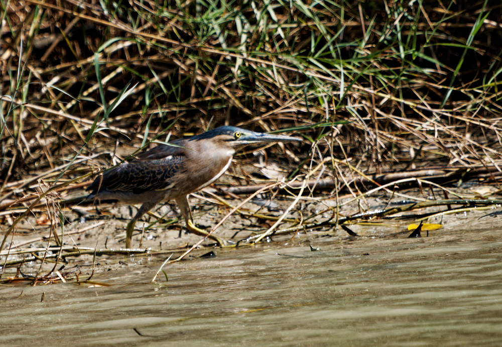 |
| A Striated Bittern on the East Alligator river. Pic by Natalie Hitchens. |
 |
| A single Pied Cormorant perched among tree roots on the East Alligator River Pic by Natalie Hitchens. |
 |
| A magnificent White-bellied Sea-eagle perched high above the river surveying the wetlands. Pic by Natalie Hitchens. |
No comments:
Post a Comment