 |
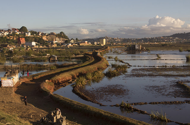
| View of Tana from Haute Ville near the ruins of the former Royal Palace. It's not mist, it's pollution. |
 |
| Tana is very hilly. The lowland areas are dotted with lakes and flooded paddy fields, most of which also serve as brick making businesses. |
 |
| Driving south on RN7, you soon leave the messy urban sprawl of Tana and dive into the rolling hills of the highlands... |
 |
| Another hilly view near Antsirabe |
 |
| More brick making businesses dot the hill sides around Ambositra |
 |
| Approaching Fianarantsoa the hills get a little more rocky and wild. There's significantly less rice cultivation. |
 |
| Into the wilds of Andringitra National Park, the highlands change shape once again revealing impressive vertical walls of rock and scrubby forests alive with ring-tailed lemurs. |
 |
| Parts of both Andringitra and Isalo National Parks look rather like the Australian bush - with lots of eucalypts and in places, red earth. |
 |
| South of Ihosy the road takes you out of the highlands into far flatter, drier, less productive landscapes... |
 |
| Open savannah in the far south of the country, 100kms from the coast. |
 |
| Dry river bed north of Toliara, the capital of the southern region, and the end of RN7 |
 |
| The reef runs several hundred kilometres north and south of Toliara It supports the local population with fish, prawns, lobster and of course, tourism. |
 |
| End of the road at Toliara (Tulear), in Western Madagascar. Sun setting over the Mozambique Channel |


No comments:
Post a Comment